Citiesreview 3: Identifikasi Pusat Aktivitas Perkotaan Menggunakan Kernel Density Estimation
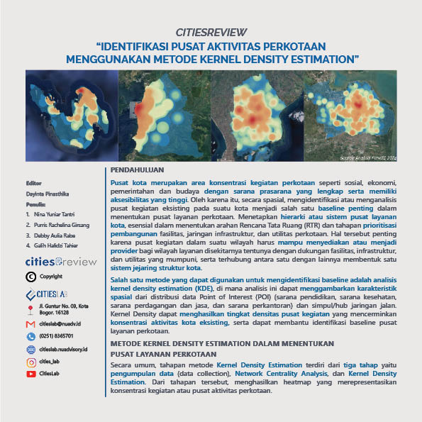
Citiesreview 3: Identifying Urban Activity Centers Using Kernel Density Estimation examines the use of Big Data to analyze spatial patterns and identify urban centers. In this Citiesreview article, data from various open sources such as Google POI, Open Street Map, and Night Time Light are used to identify urban centers based on their varying population sizes. Subsequently, this data is analyzed using the Kernel Density Analysis method, resulting in Heatmap maps showing city centers.
City centers are areas of concentration for urban activities such as social, economic, governmental, and cultural activities with complete infrastructure and high accessibility. Therefore, spatially identifying or analyzing existing activity centers in a city becomes one of the important baselines in determining urban service centers. Establishing a hierarchy or system of urban service centers is essential in determining the direction of Spatial Planning (RTR) and prioritizing the development of facilities, infrastructure networks, and urban utilities.